Saturday, November 18, 2006

More Trenchless Thoughts - Part VI

I've both seen and participated in a number of horizontal borings over the last 5 or 6 years that have allowed me to discern the nature of the relationship between knowing jobsite geology in advance and the success of the bore. Horizontal boring contractors, vendors, manufacturers, and those who administrate horizontal bores successfully have a saying:

"PLAN THE BORE, AND BORE THE PLAN!"

Prior planning, including planning for possible or potential trouble, is an integral part of an overall successful job. Knowing the GEOLOGY, in the form of a geotechnical investigation, is an important part of the overall plan. I am of the belief that if you know the geology of the borepath you can choose which method of horizontal boring is best to use.

Here's an example:

A utility owner wants to install a 24-inch diameter steel pipe underneath a road (we know immediately that this job is going to be a horizontal bore, because it would cost too much in a DOT utility permit and repair to the road to do it open-cut) and gives this information to a contractor. From a preliminary site survey, the utilty's personnel have determined that there are no conflicting utilities in the path of the bore. What other important information (besides the plan specifications and site survey) should the utility owner be prepared to give the contractor?

The contractor should require, and the utility should be ready to provide, a geologic report of the location. This report should contain all of those geologic factors that will influence the overall success of the planned installation. These factors include the soil texture, consistency, water table depth, and other parameters as needed. An auger boring is possible if sand, silt, or clay is encountered. If cobbles or boulders are encountered that are greater than 1/3 the diameter of the bore (8" diameter in this case) auger boring may not be economical. Pipe ramming may need to be considered as an alternate method.

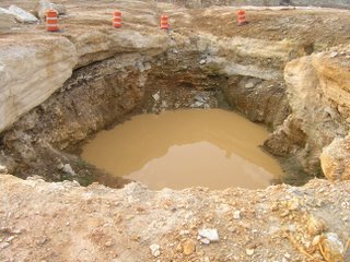
If any pits or accesses need to be constructed, their slope stability is also influenced by the soil type present. In addition, the soil strength should be considered as well, especially for the potential for settlement that would affect the overall line and grade of the boring.

These are just a few of the considerations that must be examined in detail by the geologic report. If you give the contractor a geologic report in advance of the job, expect your overall bid price to be lower because you're taking uncertainty out of the overall bid.

The National Utility Contractor's Association, or NUCA, sells a very useful text called "Trenchless Installation and Soil Compatibility Manual". See their website at http://www.nuca.org for more details.


Until next time,

Trenchless Geologist

Sunday, November 12, 2006

More Trenchless Thoughts - Part V

I've been informed of three recent jobs, one near Bolivar, Missouri, one near Springfield, Missouri, and one near Hillsboro, Missouri which all revolved around the same problem - the lack of an advance geotechnical investigation to determine the soil types present in the path of a horizontal boring.

THIS IS NOT THE WAY TO PROCEED WITH A JOB, AND IT'S ALMOST AS BAD AN OFFENSE, IN MY OPINION, AS FAILING TO IDENTIFY UTILITIES IN THE PATH OF A HORIZONTAL BORING (OR NEAR IT) PRIOR TO YOUR JOB!

If you DON'T identify the type of soil (OR ROCK), you may end up having a job that could cost twice to three times as much as you estimatecd. This is a fantastic way to lose money. You don't want to do that if you're in the business of MAKING money. Future posts will involve more job pix of this horrendous type of mistake and what it cost the contractor in terms of both time and money.

Until the next time,

Trenchless Geologist

Friday, August 25, 2006

The Nixa sinkhole - Part II

From what I've been reading online, it seems like the Nixa sinkhole is going to be filled, as it has been declared a "hazardous property" by the City of Nixa. From what I know and have heard, there seems to be little interest in discerning what caused the problem. Instead, the city wishes to solve the problem by an expedient method, keeping the cost below $100,000 total.

For the moment, all seems to be quiet on that front. Is there a cave below? Could it, if it were a cave below the sinkhole, reactivate? In 1977, a Pennsyvanian-age structure actually collapsed in the vicinity of Rainbow Drive in Jefferson City, Missouri, an event described by Jerry Vineyard, former deputy director of the Misssouri State Geological Survey in the book Geologic Wonders and Curiosities of Missouri. This sink was referred to as a "reactivated sink" Is the same in store for Nixa? We'll have to wait and watch.

For those of you who love pictures, I thought that I'd definitely show you more , taken from the air, and supplied from the website of KY-3 television in Springfield.


The photo on the left shows the subdivision that the sinkhole is in, and the one on the right shows an attempt to monitor the sinkhole from the end of a fire department "snorkel" truck. As of today, the sinkhole is now 80 feet in diameter. Will it continue to enlarge? With rain in the forecast, I'd say that enlargement will be a strong probability.

Until next time,

Trenchless Geologist

Wednesday, August 23, 2006

The Nixa Sinkhole

Little did I know that last month's post on sinkholes would be so timely. Here in Missouri, there was a collapse in the town of Nixa, in southwest Missouri. I know most of the principals involved by name, reputation, or from what the 'grapevine' tells me. First off, a series of pictures of the house that was partially destroyed, that dropped into a sinkhole 75 feet deep.


Lost in the sinkhole was the resident's garage and his Chevy Cavalier.

One of the first responders to the scene was the Nixa Fire Department. Rightly, they cordoned off the area. Geologists and other experts came to the scene at the request of the City Administrator, who also happens to be a geology graduate of Missouri State University (formerly known as Southwest Missouri State University).

There's a lot of concern right now about where the material went that was displaced when the sinkhole collapsed. Where did it go? What kind of process is being initiated here? Did the red clayey material (about 35-45 feet in thickness in other areas close to the the sink) drop into a cavern below? Is there a large cavity underneath the area, or are the residents dealing with piping of material down a joint; with a sudden loss of support in either case?

What needs to be done?

So far, there are ideas and hypotheses but little hard evidence other than the visual evidence of the sinkhole, geophysical data from resistivity measurements completed by a crew led by Mr. Peter Price of the Missouri Department of Natural Resources Division of Geological Survey, and seismic measurements that were taken by a crew led by Dr. Neil Anderson of the University of Missouri-Rolla. Dr. Doug Gouzie of Missouri State University, a karst specialist, has also weighed in with his opinions and observations. I also understand that drill holes have been completed at a "safe" distance from the sinkhole, completed to bedrock.

Response to such a catastrophe is initially a "hit-and-miss" proposition. I think that's what probably happened here. As more data is obtained, recorded, and correlated, a strategy may emerge that may protect the residents of Nixa from future collapse.

I wish all of the principals involved well with their studies. I sincerely hope they'll keep me posted as they find out more of the details, and I'll share them with you here.

Until next time,

Trenchless Geologist

Thursday, July 20, 2006

Karst - sinkholes and solution activity, naturally

Greetings.

I was looking through the computer files that I have amassed in various geological subject matter, and trenchless subject matter as well, determining how best to add to the blog. I happened to stumble across a number of photos dealing with karst.

Karst is a generic term describing the phenomena of limestone and dolomite rock dissolution over time to form sinkholes and caverns. The name 'karst' is from the former Yugoslav Karst Plateau region, an area loaded with sinkholes and caves. Karst occurs in the United States as well.

Several states are noted for the size and number of caves that they possess. New Mexico is one, with Carlsbad Caverns and Lechuguilla Cave, both within Carlsbad Caverns National Park. This is a wonderful park, and having been there, I can relate to you one fact that I know about the National Park Service, and the effort that they expend in preserving this national treasure. To make the cave accessible to all, including the disabled, they installed an asphalt walkway system. Later on, finding out that the asphalt oils were damaging the natural habitat of the cave, they decided to remove the asphalt and replace it with concrete sidewalks. Concrete is largely composed of limestone, so it was the only choice to not affect the sensitive natural habitat of a limestone cave.

Two states that vie for the title of "Most Caves" are Tennessee and Missouri. Missouri actually has billboards which read, "Missouri - The Cave State", though Tennessee has the greater number of caves. I've been in caves in both states, but now work in Missouri where I get to see a whole lot more with a clearer understanding as a geologist.

Karst topography, or the landscape produced by the terrain of caves and sinkholes, can be an engineering nightmare! Additional loads placed upon roofs of caves by highways and the vehicles that travel over them can cause collapse, and that's a BAD thing, especially when a car or truck might end up nose down in the bottom of a cavity. Part of my job as an engineering geologist is to characterize such features so that they don't affect civil engineered construction works.

Here's a photo of a sinkhole discovered during excavations for highway foundations on state Route 21 in Jefferson County, Missouri, to illustrate my point.


To effectively make this 'safe', you have to dig down into the 'throat' of the sinkhole, clean it out, and fill up the entire sink with concrete in successive 'lifts', until a firm foundation is established, one that will stand up to compaction. Then, you can fill it up the rest of the way with gravel or soil, compact it, and you're on your way again, building a highway right over it.

This is assuming, of course, that you haven't altered the natural drainage path of the groundwater, haven't affected airflow in a natural cave (important for bats and other cave critters, some endangered), or created a low spot in the landscape and filled up the only outlet from a 'bathtub'-type sinkhole. Then, you're talking about flooding, which is a whole new set of problems that you've just CREATED.

Engineering geology is a subset of the science that requires ethics - you have to think about how you affect others with what you do. Otherwise you may create more problems than you solve.

Until next time,

Trenchless Geologist

Tuesday, July 11, 2006

More Trenchless Thoughts - Part IV

One important note to those seeking to install or remediate utility product pipe is that all construction professionals should, where it's applicable, PAY the appropriate licensing fees to those people who have developed and patented a technology. It's the same thing as computer software. Somebody's BRAIN was used to develop a method, someone who is using the method should pay for using the method. If you install Windows XP on a computer, You pay a licensing fee to Microsoft when you buy the software.

The same thinking applies to trenchless methods. Until the pipe bursting patent licensed by British Gas expired last year, people were paying a charge, measured per foot and per inch of upgrade, to British Gas through the licensing authority, Advantica, Inc. The same thing is done for other methods, such as the Tenbusch Insertion Method, and the ArrowBore method. Copying the thinking behind a method can only get you into trouble. Substantial money has normally been spent in the development of such methods, it is only right for the patent holder or their licensing agency to be compensated for the privilege of using the method. Otherwise, the money spent in the development of the method is never regained.

Intellectual property rights. Respect them.

Until next time,

Trenchless Geologist

Thursday, June 15, 2006

The Interstate Technical Group on Abandoned Underground Mines (ITGAUM)

Greetings to you all from the wonderful south shore of Lake Ontario and the city of Rochester, New York. This year, I'm here as a member of the Interstate Technical Group on Abandoned Underground Mines, or ITGAUM. This group has been meeting for the last 12 years as a place where professionals in geology and engineering, particularly those from state departments of transportation, can address the hazards associated with abandoned underground mines.

This year, we viewed (at the surface) the subsidence features associated with the collapse of the Akzo-Nobel Salt Mine near Genesco, New York. This is currently in remediation, after a near-catastrophic collapse in which one area dropped nearly 70 feet straight down after only 4 hours. I'll be posting pictures of the area in the near future, with more information, ideas, and thoughts on what we can learn from this local disaster.

I'll talk more then about this group, and where it's headed.

Until next time,

Trenchless Geologist